Following the Historic Dewdney, Black Eye’s and Hudson Bay Brigade Trails
A route. A trail. A passage through history.
In the formative years of BCHBC we promoted awareness by sanctioning rides. Rides like Canada’s 125 Ride from Victoria BC to Alberta. The Hands Across the Border ride where we met Washington Back Country members at Border Lake for a photo op and social. The Grease Trail ride from Quesnel to Burnt Bridge, commemorating Alexander McKenzie’s cross continent exploration. The Challenge ’94 ride where we challenged each province and territory to explore the most equine friendly route for the proposed TransCanada Trail. Here in BC, we rode from Sooke to Nanaimo, crossed to Tsawwassen and on to the Alberta Border.
Good rides that went somewhere and promoted BCHBC.
Currently there are other opportunities for rides that start one place and end at another. One such route crosses the Northern Cascades, using old historic trails; the Dewdney, Black Eye’s and the Hudson Bay Brigade Trails. All are in use and supported by Back Country work bees individually. Little recognition has been given to these trails as a route providing the opportunity for a pack trip that goes somewhere – starting at one place and ending at another.
BCHBC is doing a tremendous service building, refurbishing and maintaining trailheads. In addition, all the trail work, advocacy and preserving our right to ride on public lands is a testament to the dedication and commitment of our members. But perhaps we could also include a little recognition of pack routes and those who travel them. I’ll describe an example.
The aforementioned route (help! It needs a name!) begins in Manning Park at the Cascade Trailhead on the Dewdney Trail. Riding up the Snass canyon you pass where the Whatcom Trail leaves and climbs up Snass Mtn. Slide debris is often floating in Dry Lake until late in the season, and further up in the spring runoff, a depression holds water blocking the trail tread when the runoff overwhelms the drainage capability. The trail tops out at Snass View camp and follows the headwaters of the Tulameen River down Paradise Valley. A good camp at the ranger’s cabin with corrals compliments of BCHBC and a big meadow is the end of a 13 km uphill ride and usually the first day.
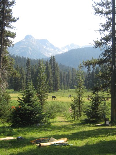 Meadows at Snass view camp.
There are many historic interests in this area.
A second day of riding leads down Paradise where we leave the Dewdney Trail and keep left on Blackeye’s Trail, ignoring the Wells Lake trail and exiting Manning Park at the Tulameen FSR. Here we use the road in preference to a narrow side hill trail to drop down and cross the Tulameen river. Horse Guard camp on the Hudson Bay Trail was the traditional 3rd nights camp of the brigades from Hope. A truly impressive feat and worthy of much study and awe. There’s not much grass here but probably sufficient for a small group. The toilet facility is up on the sidehill.
The next day’s ride leaves the river which we won’t see again until the crossing at Tulameen. The uphill climb winds thru The Defiles to the Lodestone Plateau.
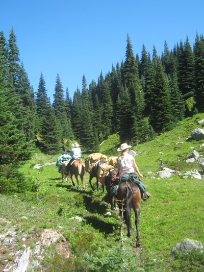 Climbing the Defiles
A hiker’s camp called Black Eye’s offers only short grass and is not usually attractive enough to entice riders. The trail then intersects with a 4-wheel drive road which encourages thoughts of developing a parallel single track for hikers and horses! Lodestone Lake is the next historic camp but again light on pasture. This is a grazing lease area and preplanning a feed drop is a good idea. The Lake is high in elevation and offers some fishing for those with the desire to wet a line.
Dropping down the north slope of Lodestone Mountain, the trail crosses the haul road from the Coalmont coal mine and climbs back up to a camp on Olivine Mountain. Reasonable feed and a hidden spring are a welcome last night camping spot.
The next morning’s ride offers views into the Tulameen Valley and across to dwellings visible on the opposing mountain, my own and some friends. The trail switchbacks down, periodically crossing old logging and mining roads, though showing in sections very old construction methods. This section of trail is shown on AC Anderson’s map as a straight line purportedly designated by Black Eye himself in 1846. After nearing the valley bottom the trail traverses downriver for a few kilometers before crossing The Tulameen River to a kiosk at the northern end of the trail.
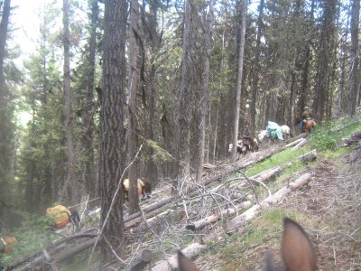 Zig-zag down the mountain to Coalmont
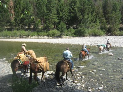 Crossing the Tulameen river.
Tulameen Town is a few km’s downriver and offers some amenities. There are BCHBC members here (such as myself) who would love to offer weary riders a genial welcome and hear the stories and memories of your packing adventure.
And an adventure it would be!
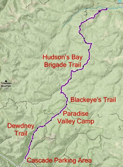 Map of the Area

BCHBC is privileged to have Saddle Up Magazine as ‘the official voice’ of our province-wide organization. We value this partnership and encourage you to check out Saddle Up magazine online and consider supporting this BC-based publication by purchasing a subscription. You may also pick up printed copies of Saddle Up in 156 cities/towns with 340 outlets, mainly in BC and Alberta, as well as other parts of Canada and the US. It’s free!
Read the March issue of Saddle Up online, including the BCHBC story. Or enjoy our feature story right here.